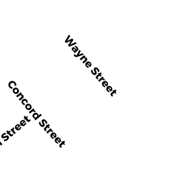
10 CONCORD STREET
Owner Information
WILLIAMS, KEVIN FLYNN
10 CONCORD STREET
NORTH ANDOVER, MA 01845


Property Details
10 CONCORD STREET is classified as a Residential Condominium (Condo-tnhs).
The primary structure on this property was built in 2008. There are 1,395ft2 of built area within this property. There is 1,395ft2 of residential/living space within this property. This property is listed as having 6 rooms.
10 CONCORD STREET is valued at $364,700. The land is valued at $0 and the structures are valued at $364,700.
The most recent deed for 10 CONCORD STREET is recorded at the local registrar in Book 15955, Page 274. 10 CONCORD STREET was last sold on Tuesday, August 13, 2019 for $390,000.
Assessment data from fiscal year 2022.
Flood Data
According to the FEMA National Flood Hazard Layer, this property does not appear to be in a flood zone. It may also be in an area not yet reviewed. Nonetheless, confirm this information prior to taking any action.
To view the flood hazards around this property, create a FEMA "Firmette" Map of the area around 10 CONCORD STREET.
Broadband Internet Providers
| Provider | Type | Bandwidth (mbps) | |
|---|---|---|---|
| Verizon New England Inc. | DSL | 5 | 0 |
| Crown Castle Fiber | Fiber | 0 | 0 |
| Viasat Inc | Satellite | 100 | 3 |
| VSAT Systems, LLC. | Satellite | 2 | 1 |
| HughesNet | Satellite | 25 | 3 |
| GCI Communication Corp. | Satellite | 0 | 0 |
| Comcast | Cable | 1000 | 35 |
| Verizon New England Inc. | Fiber | 940 | 880 |
Broadband service provider data from December 2020.
Adjacent Properties
- 334 OSGOOD STREET
Single Family Residential owned by BOURIE, CLIFFORD J - 25 CAMDEN STREET
Single Family Residential owned by MANNING, JENNIFER - 33 CAMDEN STREET
Single Family Residential owned by BRADLEY, JAMES, C. - 336 OSGOOD STREET
Single Family Residential owned by RIORDAN, JAMES, R. - 348-350 OSGOOD STREET
Other, Non-Taxable Condominium Common Land owned by Master Deed - 348 OSGOOD STREET
Residential Condominium owned by MWANDAU, PAMPHIL - 350 OSGOOD STREET
Residential Condominium owned by ANKIEWICZ, EDWARD